|
Servidor de datos
de las Estaciones Permanentes GPS de la Escuela Técnica Superior de Ingenieros
en Topografía, Geodesia y Cartografía de Madrid
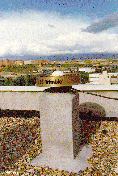
La E.T.S. de Ingenieros en Topografía, Geodesia y Cartografía de Madrid tiene instaladas dos estaciones permanentes GPS. Con objeto de compartir recursos, y acercar datos de calidad a alumnos y profesionales del sector, la Escuela opera desde el año 1998 la estación GPS MERC, y también, encuadrado dentro del Proyecto IBEREF-GPS, opera la estación GNSS MER2. Ambas estaciones están equipadas de receptor de doble frecuencia y antena geodésica tipo 'choke ring'. Disponen de coordenadas de precisión y acceso gratuito a los datos que se registran a intervalos variables desde 1 segundo, 5 segundos y 30, en archivos horarios y diarios, almacenados en formato RINEX.
© ETSITGC/UPM 1998-2005 http://gps.topografia.upm.es Global Navigation Satellite Systems, GNSS, EGNOS, GPS, Galileo, Compass, Glonass, Beidou, CORS, RTK, IRNSS, DORIS, Space Geodesy, Trimble, Leica, Topcon, Sokkia, Ashtech, Optech, Riegl, Spectra Precision, Veripos, Javad, Hemisphere, Altus, Septentrio, OxTS, NovAtel, Applanix, Multi-Spectral Sensors, LaDAR, Light Detection and Ranging, Airborne and Terrestrial LiDAR, Mobile LiDAR, Mobile Mapping, 3D Point Cloud, Optics, Robotics, Mechatronics, 360° Field of View, Panoramic Imagery, 3D Vision, libLAS, Sonar, Radar, Doppler LiDAR, ALS, INS, IMU, ILRIS, ALTM, LMS, SPAR, ELMF, ILMF, Android OS, Apple iOS, iPhone, iPad, Galaxy Tab, SmartPhone, Symbian, Handheld, Tablet, Apple, Blackberry, Motorola, Nokia, Ovi, Samsung, Galaxy Note, MoMo, Wi-Fi, Kindle Fire, Google Maps, Bing Maps, MapBox, ArcPad, Asus Transformer Pad Infinity, HTC, MediaPad, MWC, Windows, Phone, DROID, Mobile Apps, Cellular Network, GSM CID, 4G, Mobile Mashups, Mobile Web, GeoWeb, HTML5, Objective-C, Xcode, Cocoa, Cocoa Touch, ArcGIS Runtime SDK for iOS, ArcGIS Runtime SDK for Android, ArcGIS API for Flex, Google Earth for Android and iOS, MapQuest Native, Mobile Mapping API, MobiGIS, Bing Maps, Android SDK, JQueryMobile, GeoLocation API with PhoneGap, OSGeo, OGC, GML, KML, GRASS, Quantum GIS, gvSIG, PostGIS, Python, Web Services, WFS, WMS, MySQL, FOSS, FOSS4G, GeoTools, GDAL, OpenLayers, OpenStreetMap, MapBuilder, OSSIM, MapServer, GeoServer, PROJ, GeoNetwork, MapBender, Ka-Map, Chameleon JUMP/OpenJUMP, MapWindow, GEOS, uDig, GeoMoose, GeoMajas, Earth Observation, Hyperspectral Imaging, Photogrammetry, Image Processing, GEOSS, Pattern Recognition, 3-D Stereoscopic Imagery, Acquisition, Spatial Resolution, GMES, Computer Vision, SAR, InSAR, IfSAR, ASPRS, ISPRS, Radar, Microwave, Thermal, EOS, NASA, ESA, ERDAS, Imagine, ENVI IDL, UltraCam, MATLAB, SEIS, NSDI, GSDI, UNSDI, FGDC, INSPIRE, GeoDATA, GeoPortal, Metadata, National GIS, Standards, Interoperability, Geospatial Law Policy, Geospatial Data Integration, Data Harmonization, Data Specification, Legislation, Clearinghouse, Web Services, NSDI 2.0, ISO 191xx, OGC, GML, XML, NSGIC, URISA, TUCBS, UCGIS, GITA, MAPPS, Intelligence Surveillance and Reconnaissance ISR, Military Operations, C4ISR, Army, Navy, Marine, Air Force, Secret, Security Clearance, NATO Clearances, Ex Forces, UAV/UAS, Defence, Aerospace, NGA, NCGIS, USGIF, HUMINT, MASINT, SIGINT, OSINT, TECHINT, Multi-INT Analytics, Big Data, DNI, DoD, NRO, NSG, Emergency Management, GI4DM, Natural Hazards, Landslide, Flood, Earthquake, Tsunami, Nuclear Accident, Disease, Tornado, Oil Spill, Emergency Planning and Responses, Regional Security, Conflict Management, E911, Public Health and Safety, Medical Intelligence, GIS for Personal Health, GeoICT4DM, UN-SPIDER, UNOOSA, UN Committee on Peaceful Uses of Outer Space, and Space-Based Technologies for Disaster Risk Management, Forestry, Natural Resources, Wildlife, Agriculture, Silviculture, Horticulture, Aquaculture, Agroforestry, Biodiversity, Botany, Ecology, Fisheries, Forest Management, Restoration, Nature Conversation, Forest Research, Precision Farming, Crop Yield Estimation, FAO, Farm Bureau, UN, IUFRO, EFI, USDA, EPSG, Oil and Gas Pipeline, Mining, Geology, Natural Gas, Petroleum, Exploration, Production, Distribution, Operation, Route Selection, Alignment Sheets, Integrity Management, LNG/LPG, Oil Spill Mapping, Offshore, Rig, Subsea, Nabucco, Shell, BP, ExxonMobil, Chevron, Conoco Phillips, Total, APDM, PODS, PUG, Land Administration, Land Registry, Land Tenure, Land Survey, Land Law, Land Policy, Cadastral Surveying and Mapping, Land Markets, Land Consolidation, Land Use Planning, Re-Engineering and Cadastral Reform, Land Taxation, Land Records, Real Estate, GLIS, Cadaster, Kadaster, NSPS, ACSM, PLS, RICS, FIG |

